Bidborough, Kent
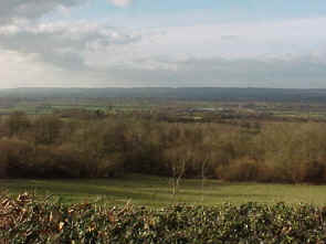
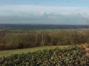
The view looking north from Bidborough Ridge
Road.
In the 15th century, the Culpepers owned a considerable potion of this valley.
Photographs taken March 2000 by Warren Culpepper
Sir Thomas Culpeper6bh will of
1428: "The manor of Bernet in Leghe, Penserst, Bitteberg
(Bidborough)
and Tonbregge, with the mill of Greenerssh and lands called
Scottegrove in Asshe, Gatewicke mede in Otteford, and rents and farms
in Sele and Sevenoaks, to Thomas my son and his heirs, remainder to
Nicholas his brother, remainder to the heirs of me and Joyce lately my
wife, remainder to my right heirs."
1831 Topographical Dictionary
BIDBOROUGH, a parish in the hundred of WASHLINGSTONE, lathe of
AYLESFORD, county of KENT, 3 miles SW
from Tunbridge, containing 192 inhabitants. The church is
dedicated to St. Lawrence.
Location: Off
the B2176, 15 miles SW of Maidstone and 12 miles NW of Goudhurst.
National Grid Coordinates: TQ
565 432


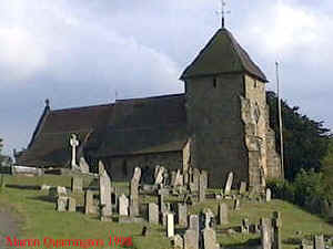 St.
Lawrence Church
St.
Lawrence Church